Interested in living in Sierra Blanca?
Sierra Blanca is an exclusive residential area located in Marbella, known for its luxury properties and stunning views of La Concha Mountain and the Mediterranean Sea.
From towering mountains to hidden caves and dramatic cliffs, the Costa del Sol boasts some of the most striking and unique geological formations in southern Europe.
· 14 min. read
Spain’s stunning 150 kilometre stretch of sunny coastline renowned for its paradisiacal lifestyle, warm climate, and vibrant culture offers more than the sandy shores of the Mediterranean Sea and lush greenery of its perfectly manicured golf courses. From towering mountains to hidden caves and dramatic cliffs, the Costa del Sol boasts some of the most striking and unique geological formations in southern Europe. These natural landmarks not only shape the landscape, but also play a crucial role in the region’s culture, with legends woven into the very rocks.
We take a look at 10 of the most iconic natural wonders found on the Costa del Sol, and their significance to the people who live here.
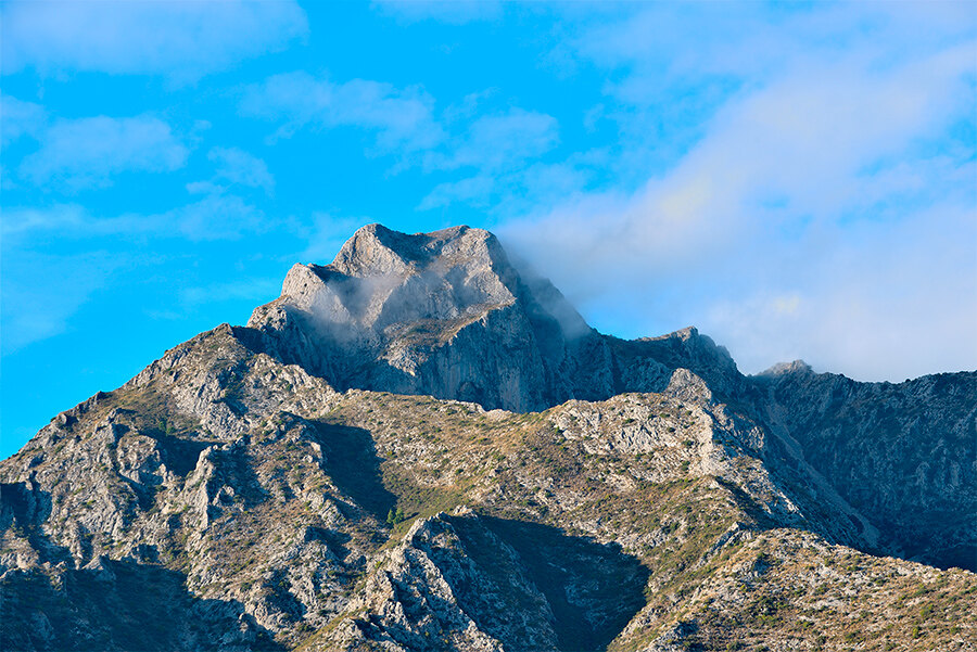
Nestled just behind the town of Marbella, the Sierra Blanca mountains are as iconic to the region as its golden beaches. Their name, which translates to “White Mountains,” comes from the pale grey limestone that forms the backbone of this impressive range. The prominent peak of La Concha (Pico de la Concha), rising up to 1,215 meters, dominates the skyline and offers breathtaking panoramic views from its summit, providing Marbella with its quintessential postcard aesthetic.
The Pico de la Concha, also known as "Seashell Peak" due to its distinctive seashell-like shape when viewed from the west, is the second-highest peak in the range, just behind Pico Lastonar at 1,275 meters. Other notable summits include the Salto del Lobo (1,225 meters), Cerro de la Zarina (1,141 meters), and the Cruz de Juanar (1,178 meters).
These limestone mountains are affectionately called the "guardians" of Marbella, protecting the town from cold northern winds and creating a unique microclimate. This results in milder winters, hot, dry summers, and ideal water temperatures that contribute to the region's calmer seas.
In the summer, the Sierra Blanca mountains serve as a remarkable amphitheatre-style setting for the renowned Starlite Festival, an epic natural venue for the live music performances that feature both national and international artists.
The Sierra Blanca mountains were shaped during the Alpine orogeny around 65 million years ago, when tectonic activity caused the African and Eurasian plates to collide. This collision created the Betic mountain range, and erosion has since sculpted the limestone into the rugged terrain we see today.
Sierra Blanca is an exclusive residential area located in Marbella, known for its luxury properties and stunning views of La Concha Mountain and the Mediterranean Sea.
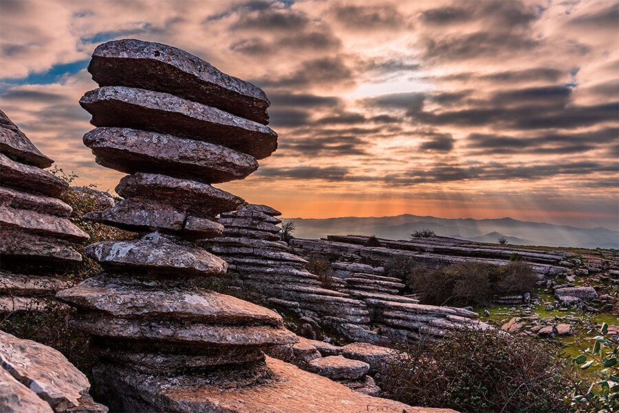
A short drive inland from the Costa del Sol, El Torcal de Antequera is one of Spain’s most remarkable natural landmarks, and one of the best-preserved examples of a karst landscape in Europe.
Known for its eerie rock formations—twisted limestone pillars and balanced boulders that look like they belong in a surreal painting, rather than the natural world, were formed over hundreds of millions of years ago.
Natural rock “sculptures” that resemble animals, faces, and otherworldly forms engulf the area, among the most famous formations are El Sombrerillo ("The Little Hat") and El Tornillo ("The Screw"), a UNESCO-listed rock feature that spirals up like a large screw, showcasing the intricate effects of weathering and erosion.
If you want to feel like you’re walking through time across ancient grounds or straight onto a movie set of great space-fairing adventures, this is the hike for you! To add mystery to the marvel, local folklore tells of a lost civilisation that once inhabited El Torcal, whose people angered the gods and were turned to stone.
The entire area was once submerged beneath the Tethys Ocean over 200 million years ago. When tectonic shifts caused the ocean floor to rise, layers of sedimentary limestone—composed of marine fossils and minerals—were exposed to the elements, eventually forming a plateau. Over millennia, rainwater rich in carbon dioxide carved intricate patterns and pathways through the rock, creating El Torcal’s signature maze of fissures, caves and towering formations.
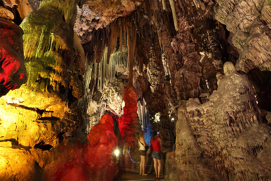
The Caves of Nerja, located just outside the coastal town of Nerja which sits 50 kilometres to the east of Málaga city, are one of Spain’s most important natural and archaeological treasures. These vast caverns, which stretch over five kilometres, feature impressive stalactites and stalagmites, as well as prehistoric cave paintings dating back over 20,000 years.
The caves have long been a place of mystery. Ancient cave paintings depict scenes of animals and human figures, offering a glimpse into the lives of early inhabitants of the region. According to local legend, the caves were used as a refuge during times of conflict and may have once hidden treasures from pirates and bandits. Today, the caves host concerts in their vast chambers, where the acoustics add a haunting beauty to the music.
The caves were formed over millions of years as water, rich in calcium carbonate, seeped through cracks in the limestone, creating hollow spaces. Over time, these spaces expanded, forming the impressive chambers and formations that we see today. The discovery of the caves in 1959 revealed not only their geological beauty but also their importance as a historical site.
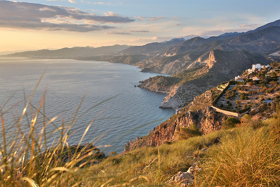
Continuing east along the Costa del Sol, between Nerja and Almuñécar, lies the magnificent Cliffs of Maro-Cerro Gordo, a Natural Park renowned for its dramatic landscape, ancient pine forests and vibrant marine life that thrives in its protected waters. Rising sharply from the Mediterranean Sea, the rugged limestone cliffs offer some of the most breathtaking views in southern Spain. The cliffs are dotted with hidden coves, pristine beaches, and crystal-clear waters, making them a paradise for those seeking an unspoiled and serene experience of the Andalusian coastline.
Historically, the cliffs have been a place of refuge. Fishermen and villagers used the coves to hide from pirates and invaders who once plagued the Mediterranean coast. These secluded spots provided a natural defence and shelter, with some stories saying that smugglers used the cliffs to hide treasures. Today, these same cliffs are a popular destination for adventure enthusiasts, with snorkelling and diving being a popular activity, particularly as some of the coves are only accessible via boat.
The cliffs were shaped over millions of years by tectonic forces and relentless erosion caused by waves and wind. The land itself was once part of the seabed, but over time, as tectonic shifts raised the earth, the softer layers of limestone were carved away, leaving behind towering cliffs and secluded beaches, which now form one of the most spectacular coastlines in Andalucía.
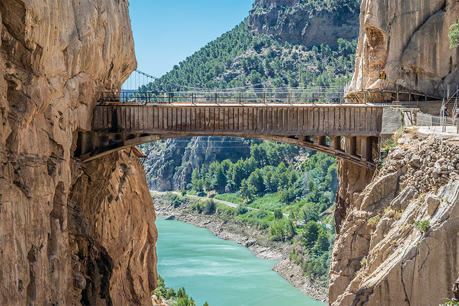
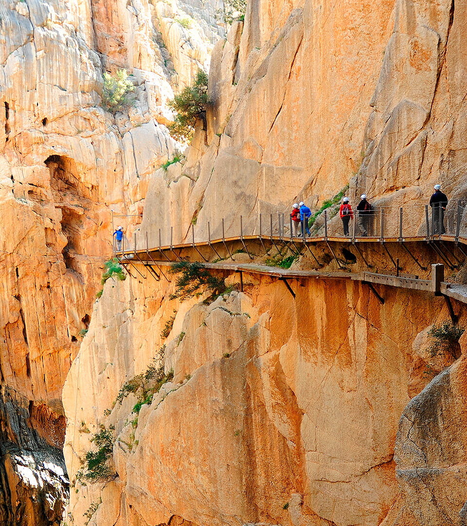
Inland from the coast, the Guadalhorce Gorge and its famous trail, El Caminito del Rey, are among the most thrilling geological wonders of the Costa del Sol.
This narrow gorge is flanked by steep cliffs and is home to one of the most exciting walking paths in Spain. As of 2006, it has been included in the Andalusia-Morocco Intercontinental Biosphere Reserve of the Mediterranean and listed among the Places of Community Importance in the Mediterranean Biogeographic Region.
The Guadalhorce Gorge was shaped through millennia by the Guadalhorce River, which, through constant erosion, slowly wore away the limestone rock, deepening and shaping the canyon into an impressive natural wonder. Over time, the river’s waters have also shaped the surrounding landscape, creating a variety of stunning rock formations, caves, and natural pools. The gorge is a textbook example of karst topography, where limestone is eroded by water, resulting in dramatic cliffs and deep ravines.
The Caminito del Rey, or “King’s Path”, was originally constructed in the early 20th century to provide access for workers at the nearby El Chorro Hydroelectric Plant, facilitating the transport of materials and tools. This narrow, perilous pathway clings to the cliffside, high above the gorge, offering dramatic views of the river below and surrounding rocky landscape. The trail earned its royal name after King Alfonso XIII crossed it in 1921 during an official visit, cementing its place in Spanish history.
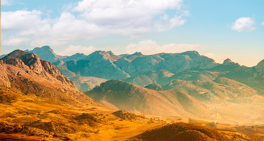
With Málaga city at its base, the Montes de Málaga “Mountains of Málaga” sit just five kilometres from the city, offering a world of rugged terrain and peaceful forests just north of its centre. These mountains, often overshadowed by the more famous peaks of the region, provide serene beauty and stunning views over the city and coastline. The Montes de Málaga have long been a place for locals to escape the hustle and bustle of the city.
Characterized by rolling hills, dense forests, and rocky outcrops, the range forms a natural barrier between the city of Málaga and the interior of the province. It stretches for around 20 kilometers from the Málaga Bay to the inland areas. The highest point in the range is Cresta de la Reina, which rises to 1,032m above sea level. Historically, the area was important for timber and firewood production.
Like much of the region, the Montes de Málaga are composed of limestone, shaped by tectonic activity and centuries of erosion. These mountains are a result of the same geological processes that formed the surrounding ranges, but their less dramatic peaks have made them a more tranquil retreat.
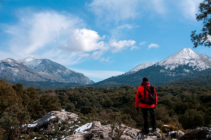
Located to the northwest of Marbella, the Sierra de las Nieves is a UNESCO Biosphere Reserve, and is considered one of Andalucía's most beautiful areas. It is one of the most recent additions to Spain’s network of National Parks, and contains an impressive 93,930 hectares (362.7 square miles) of protected land within its boundaries, as well as 14 charming villages such as Istán, Yunquera and El Burgo, all steeped in rich history, culture and traditions, bringing to life the regions rural heritage.
Sierra de las Nieves translates as “Mountain Range of the Snows” or “Snowy Mountains,” which is a name that pays homage to the snow-capped peaks in winter, when the region’s highest summits are often dusted with snow. The park is part of the larger Baetic Cordillera, a range that stretches across the southern part of the Iberian Peninsula. The Sierra de las Nieves itself is home to several distinct subranges, including the Sierra del Pinar and Sierra de Tolox, each offering its own unique geological features and diverse ecosystems.
One of the defining characteristics of the park is its varied topography. Limestone and peridotite formations create steep slopes, deep valleys, and an intricate network of ravines and cliffs. The eastern sector in particular, is renowned for its dramatic relief and sharp peaks. This is where the GESM Cave is located, the third-deepest cave in the world, which plunges to depths of more than 1,100 meters. The park is also home to some of the highest points in the region, such as La Torrecilla, the second-highest peak in the province of Málaga, which reaches nearly 2,000 meters in elevation and sits more or less in the centre of the National Park.
The park’s rivers, including the Guadalevín and Río Grande, originate from the heart of these mountains. Over millennia, these rivers have carved out spectacular canyons, deep gorges, and meandering valleys, further accentuating the park's rugged beauty. The waters of these rivers provide vital irrigation to the surrounding regions, supporting both agriculture and the local population. Their meandering paths have created fertile pockets of land, particularly in the valleys and along the riverbanks, where diverse flora and fauna thrive. The Sierra de las Nieves was formed through the same tectonic activity that created much of southern Spain's mountainous terrain, resulting in the stunning karst landscape we see today.
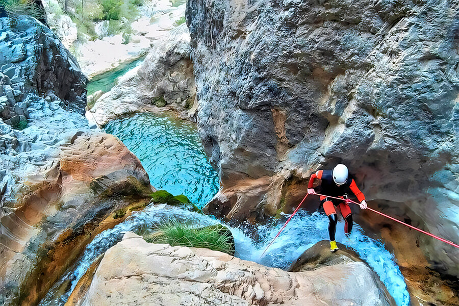
Tucked away in the Sierra de las Nieves Natural Park, the Rio Verde Canyon is a must-visit for adventure seekers wanting to experience crystal-clear turquoise waters surrounded by stunning natural rock formations. The river has no banks, just steep rocky slides covered in rich green tropical vegetation. Access is only possible through the river, an activity known as “Canyoning.”
Although this site is lesser-known than some of the others on the Costa del Sol, it still remains the most impressive canyon in Andalucía, complete with narrow channels, water chutes and waterfalls. The water here is always icy cold, even in the heat of summer, reminding you that it was once snow sitting atop the peaks of Sierra Nevada.
The Rio Verde Canyon was carved by the Verde River over thousands of years. The river’s constant flow gradually wore down the limestone rock, creating deep gorges, natural pools, and waterfalls that now define this breathtaking landscape.
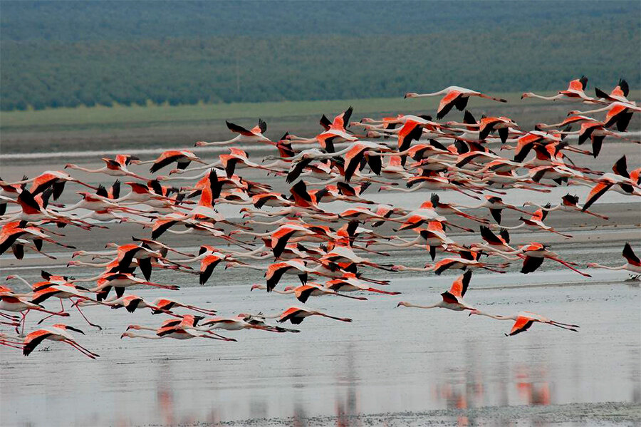
While not a geological formation in the traditional sense, the Fuente de Piedra Lagoon, located near Antequera, is an intriguing natural phenomenon.
This saline lagoon is the largest of its kind in Andalucía and is an important stop for migratory birds, particularly flamingos. The lagoon is important for local agriculture, particularly in salt production, and it also holds ecological importance as a nature reserve. The flamingos and other migratory birds are an integral part of the local identity, and local legends often speak of the lagoon’s healing powers, believed to be derived from its mineral-rich waters.
The lagoon is the result of a combination of geological processes, including the evaporation of ancient inland seas and tectonic activity that led to the formation of the depression in which the lagoon lies. The salinity of the water is due to the evaporation of water over time, leaving behind high concentrations of salt and minerals.
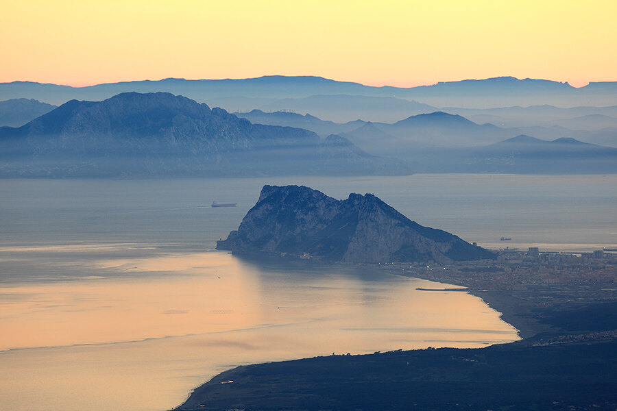
While technically part of the British Overseas Territory of Gibraltar, the iconic Rock of Gibraltar is a major geological landmark visible from the Costa del Sol.
Its towering limestone cliffs rise sharply from the sea, and it has long been a key feature of both the region’s history and geology. The Rock has been the site of many historical events, including sieges, military campaigns, and territorial disputes. It also holds deep symbolic meaning for both the British and Spanish people. Legends tell that the Rock of Gibraltar is one of the Pillars of Hercules, marking the boundary between the known world and the unknown.
The Rock of Gibraltar is a limestone ridge that emerged millions of years ago during the Jurassic period. The region's tectonic activity, coupled with sea erosion, shaped this imposing landmark. Over time, the rock became a major maritime landmark for sailors navigating the Mediterranean.
As we've explored these 10 geological wonders of the Costa del Sol, it’s clear that this captivating region offers far more than just beautiful beaches and vibrant nightlife. While the architecture of historic buildings and luxurious villas is undeniably impressive, it’s the awe-inspiring design of the region’s natural landscape that truly leaves a lasting impression.
Whether you're an adventure seeker looking to explore the rugged trails of the Sierra de las Nieves or simply marvel at the natural world, the Costa del Sol invites you to step back in time and connect with the geological history that makes this part of Spain so extraordinary.